What Is a Geo Grid Rank Tracker?
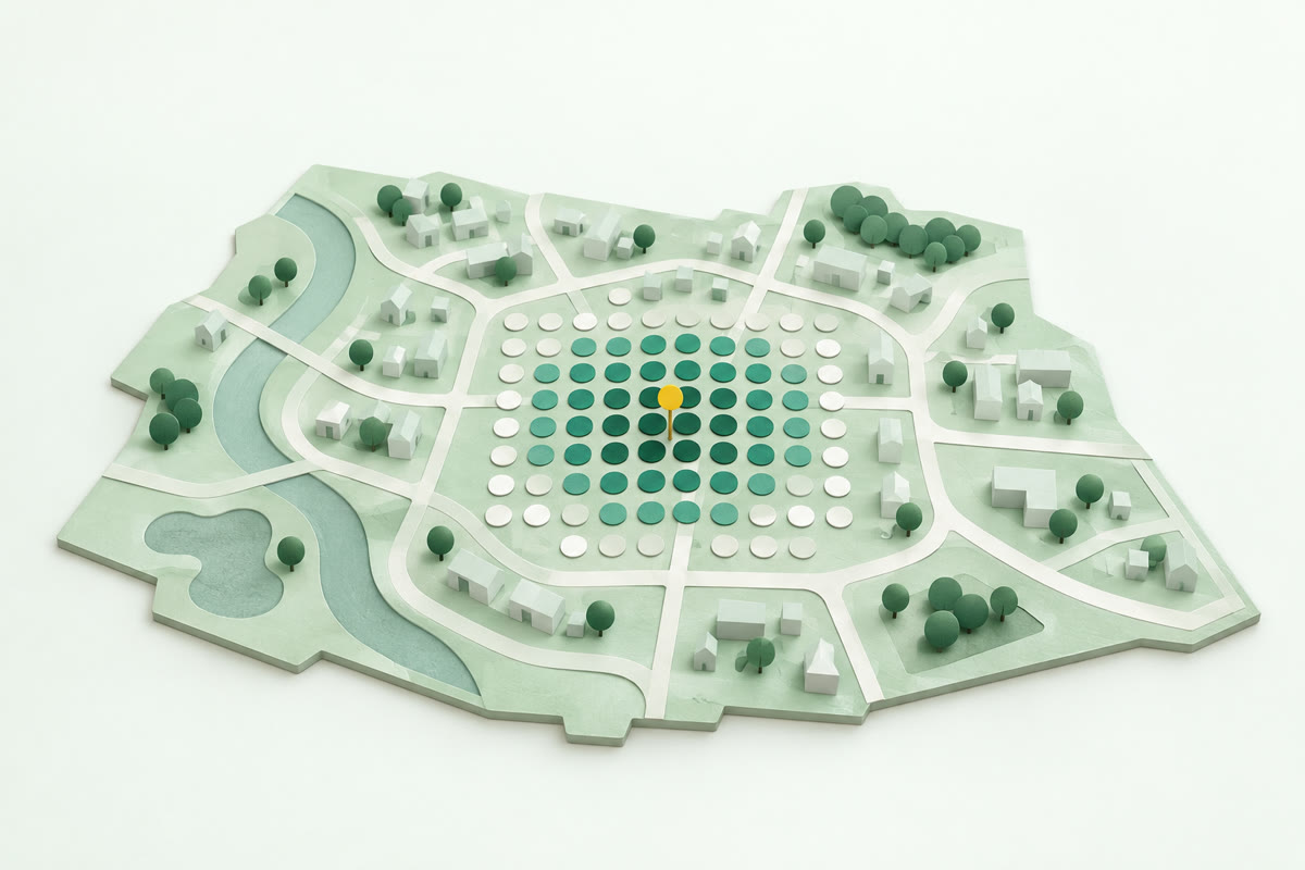
A geo grid rank tracker shows where you rank on Google Maps as a coloured map, by running the same search from many spots. Searching from your own shop, salon or surgery in a UK town gives one number from one place. Spots are places customers could search from, so the map shows where they stop seeing you. A green spot usually means you're in Google's top 3 there: the first three businesses Google Maps shows, which get most of the calls.
- One search isn't the whole picture. Search for your business from your own shop and you'll often look near the top, while a customer two miles away doesn't see you at all. The map results change with where the person searching is, and Google may use what they've searched before.
- Who beats you, and where. A geo grid shows which businesses are in the top 3 at each spot, and Local Rank Tracker lets you switch the map to any competitor in one tap, at no extra cost.
- Where to put the work. The map from a geo grid shows which part of town is weak for you. You can't move your premises, but you can pick the right categories, keep your Google Business Profile complete, earn reviews steadily and get listed on the sites customers check.
How does a geo grid rank tracker work?
A geo grid rank tracker works by searching Google Maps separately from each spot, as a customer standing there would, and recording your position at each one. You pick one search a customer would type, such as "plumber", and one area for the spots to cover. Google ranks local results partly on distance, meaning "how far each business is from the customer who's searching", so each spot can return a different list of businesses. Coloured by your position, the spots together show where you're in Google's top 3, the first three businesses Google Maps shows, and where you drop away.
- Choose the search and the area. The search is what a customer would type into Google Maps, such as "boiler repair", and the area is the place you serve, such as Haxby or the YO32 postcode district.
- Spread the spots. Spots are laid across the area, and each one stands in for a customer searching from there.
- Search from every spot. One search runs from each spot, so a map of 40 spots is 40 searches.
- Record and colour each spot. Your position in the results at each spot is saved, and the spot is coloured to match.
Each search in a Local Rank Tracker scan is run as a new customer's phone would, with no search history, so the results at each spot aren't shaped by anything you've searched for.
If your address is hidden, as it is for lots of trades that show a service area instead, tell us the town or postcode you work from, and every map starts there.
How many spots you get depends on the size of the place. A village is often 15 to 30 spots and a town 40 to 80.
A scan shows what Google showed when it ran. Google's results can change, so one scan is a snapshot. To see whether the green is spreading, run the same search over the same spots again later and compare the two maps. On a plan, we check your searches every week, and any change you tick off on your report sits next to what your map did afterwards. Rankings also move for reasons nobody controls, so look for a pattern over a few scans.
How do you read a Google Maps rank heatmap?
You read a Google Maps rank heatmap by taking each spot's colour as your position for someone searching there, then following the green out from your base. Green usually means you're in the top 3, the first three businesses Google Maps shows. Amber or yellow usually means further down the list, and red means low down or missing. Always check the map's key, because the positions each colour covers differ from tool to tool. Then look at who's on top at your weakest spots, because those are the businesses customers there see first.
Local Rank Tracker's key has four bands: green for the top 3, amber for 4 to 10, red for 11 to 20 and grey for not found. Your position is printed on each spot, and grey spots show "20+" instead. So an amber 7 means a customer searching from that spot sees six businesses above yours. Tap any spot to see the full top 20 a customer there would see.
Two numbers sum up the whole map. Top 3 share is the share of spots in your town where you're in Google's top 3, the results that get most of the calls. SEOs call it Share of Local Voice (SoLV). Average position is your usual place in the results at the spots where you show up in the top 20. It leaves out the grey spots, so read it together with how many there are, not on its own.
Once you know who's on top at a weak spot, switch the map to that business to see where it wins across your town.
The colours show where you're weak, not yet why.
What do red spots on the edge of your area usually mean?
Red spots on the edge of your area usually mean other businesses that match the search are nearer the customers there, so they rank above you. Google's help page on local ranking says local results are "mainly based on relevance, distance and popularity". The page defines distance as "how far each business is from the customer who's searching". The further a spot is from your base, the more likely it is that another matching business sits nearer the people searching there. So some red at the edges is normal: you can't move your premises closer to everyone. What red covers depends on the map's key: low down the list, missing altogether, or both.
- Red at the edges: Red spots only around the edge of your map, with green near your base, usually come down to distance and are normal for a business working from one base.
- Red on one side: Red spots on just one side of your map often mean businesses based on that side are nearer the people searching there. Tap a red spot to see who's on top there.
- Red everywhere: When red spots cover the whole map, close to your base as well as far out, your profile may not match the search well, or your business may not be well enough known and reviewed.
On a Local Rank Tracker map, red still means you're there, 11th to 20th, and grey means you're not in the top 20 at all. So a customer at a red spot can still find you by scrolling down the list.
How far out from your base you stay green is sometimes called your ranking radius. Distance sets part of it. The part in your hands is your profile and your reviews.
Is a geo grid the same as a Google Business Profile heatmap?
Yes, a Google Business Profile heatmap is another name for a geo grid's map, because Google Business Profile has no ranking map of its own. Google Business Profile's Performance report shows views, the search terms people used to find you, and actions such as calls and directions, not where you rank from place to place. The profile's Insights give recommendations built from public, location-based information such as customer reviews, photos and local search trends, not your rankings. So a Google Business Profile heatmap comes from a geo grid tool that runs the same search from many spots.
A geo grid rank tracker's map, and the spots on it, go by several names:
- Geo grid, geogrid or local search grid: All three names mean the set of spots spread over the area being checked.
- Grid scan: A grid scan in local SEO is the run of searches, one from every spot in the grid.
- Rank heatmap or local SEO heat map: Both names mean the coloured map a grid scan produces.
- Pins or grid points: Some people use these words for the spots themselves, the places each search is run from.
Many people use grid scan and heatmap for the same thing. Where they're told apart, the scan is the process and the heatmap is the result, the coloured map you read.
None of these is a website click heatmap, the kind that tracks mouse clicks and scrolling on a web page.
Why do some grids put spots in the sea or in fields?
Some grids put spots in the sea or in fields because a square grid spaces its spots evenly over the map, whatever is underneath. On the coast, some spots land in the water. Inland, some land in fields and the next village, outside the place you're checking. A spot in the sea or a field tells you nothing about your customers. When Local Rank Tracker lays out your free scan, the spots follow the real outline of your town, village or postcode district, and any over water are dropped before the searches run.
Wasted spots can cost you too. On any geo grid rank tracker that charges per spot, you pay for each spot's search, whether or not anyone could be searching from there. Our credits work the same way: one credit is one search from one spot on the map. That's why spots over the sea are left out automatically and never charged.
Inland, the area comes from the real outline of your town or village in Ordnance Survey data, or from your postcode district. That stops it spilling into the fields and the next village.
Town shapes and postcode districts cover Great Britain. Square areas work everywhere, Northern Ireland included.